Event-triggered drone
Automatically finds target
Sends video through bonded channels
Sends video through bonded channels
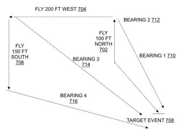
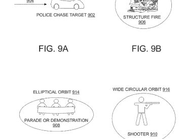
The system employs direction-finding triangulation to pinpoint the event's latitude, longitude, and elevation. The drone autonomously executes optimized flight profiles.
Sends video through bonded channels
Sends video through bonded channels
Sends video through bonded channels
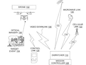
Data transmission utilizes bonded and blended communication channels to ensure reliable video streaming to users, such as first responders or news agencies.
U.S. Patent No. 12,585,288
Sends video through bonded channels
U.S. Patent No. 12,585,288
A drone for capturing aerial imagery launches automatically when it detects predefined target events, such as structure fires, explosions, gunshots, emergency sirens, a specific license place, or a specific face.